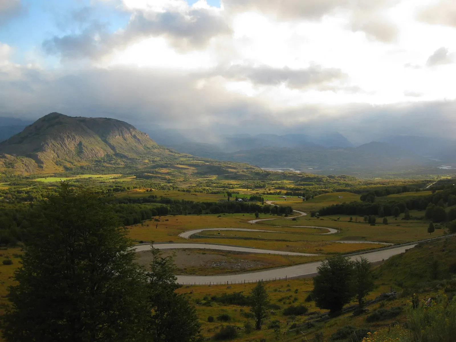
The Carretera Austral winding through a green Patagonian mountain valley

Route guide

Chile's Carretera Austral: Puerto Montt to Balmaceda

Chile's Carretera Austral is a remote Patagonia expedition road, not a normal paved touring loop. Chile Travel describes Route 7 as more than 1,200 km from Puerto Montt toward Villa O'Higgins, with gravel, variable weather, ferry crossings and limited services. A 10–14 day partial or central-southern trip is more realistic for many first-time visitors than attempting the full road under a rigid schedule.

See the route snapshot
Puerto Montt → Villa O'Higgins or a planned turnaround point10-14 daysDemanding

Route snapshot

Decide from the constraints first

Core distance
More than 1,200 km end-to-end before side trips, ferries and access roads
Pure drive time
No single non-stop estimate is operationally useful; ferry timing, gravel, weather and service gaps control the schedule
Driving side
Right
Road character
Mixed pavement and gravel with ferry crossings
Road
Route 7 with paved and gravel sections
Ferries
Required on key northern and southern connections; reserve where applicable
Services
Limited on remote sections; carry provisions and maintain fuel margin
Vehicle
Chile Travel recommends an all-terrain vehicle
Connectivity
Plan for weak or unavailable signal in small and remote settlements

Fit check

Is this route a good fit?

Use these tradeoffs before booking accommodation into a fixed sequence.

Good for

  • Experienced self-drive travelers who understand that ferries, gravel and weather are part of the itinerary rather than inconveniences around it.
  • Travelers comfortable carrying provisions, offline information and schedule buffers through areas with limited services.
  • Outdoor-focused travelers willing to reduce daily distance to preserve time for parks, hikes and remote towns.

Think twice if

  • You need a predictable hotel arrival time every night or cannot tolerate ferry and weather changes.
  • You expect continuous fuel, mobile signal, ATMs or mechanical services comparable to a major highway corridor.
  • You are not comfortable with gravel, remote-road preparation or the rental-company restrictions attached to an all-terrain vehicle.

Trip length

Minimum, recommended, comfortable

Trip length is treated as a planning choice, not a single magic number.

Minimum

7 days

Best treated as a focused northern or central section, not a complete Puerto Montt–Villa O'Higgins expedition. Chile Travel publishes a seven-day sample using a partial itinerary and airport strategy.

Recommended

10–14 days

A stronger first trip for Puerto Montt/Hornopirén, Chaitén/Pumalín, Queulat, Coyhaique and the General Carrera / Río Tranquilo area with ferry and weather margin.

Comfortable

14–21 days

Appropriate for deeper southern travel toward Tortel/Villa O'Higgins, longer hikes, ferry uncertainty and deliberate buffer days without driving every day.

Driving rhythm

Why map time is not trip time

  1. 01

    Ferry bookings are itinerary anchors. Chile Travel specifically notes crossings at Caleta La Arena, Puerto Yungay and other points, so road mileage alone cannot determine the day.

  2. 02

    Assume services become less frequent as the route gets more remote. Carry provisions and maintain fuel margin instead of planning to arrive nearly empty at the next town.

  3. 03

    Use an all-terrain vehicle only within rental-company permissions. Chile Travel recommends one because gravel and variable weather are real constraints, but vehicle capability does not remove the need for conservative driving.

Vehicle choice

Match the vehicle to the road

Suitability is separate from rental-company permission. Verify the booking terms for your exact vehicle.

Not recommended

Standard low-clearance car

Chile Travel explicitly recommends an all-terrain vehicle for the route because gravel sections and variable conditions remain part of the journey.

Good fit

SUV / all-terrain vehicle

The most defensible default for the route, provided the rental contract allows the intended roads and ferry use.

Check restrictions

Camper / 4x4 camper

Can suit the route but requires careful ferry dimensions, overnight rules, fuel planning and rental permissions.

Not recommended

EV

Do not assume charging coverage across remote Route 7. A future EV recommendation would require verified route-specific charger data that this project does not currently maintain.

Core itinerary

A practical planning spine

This is a realistic backbone, not a requirement to complete every attraction listed.

Day 1

Puerto Montt → Hornopirén

Approx. 100–130 km plus ferry · Road-and-ferry opening day

Priorities

  • Confirm ferry booking/timing
  • Fuel and provisions before leaving larger service areas
  • Avoid a late first crossing

Overnight: Hornopirén

Day 2

Hornopirén → Chaitén

Ferry-led day plus local driving · Bimodal ferry / road day

Priorities

  • Treat ferry schedule as fixed constraint
  • Keep arrival plans flexible

Overnight: Chaitén

Do not assume the road is continuously driveable between these towns without ferry segments.

Day 3

Chaitén → La Junta / Puyuhuapi

Approx. 150–200 km depending on base · Mixed-surface remote driving

Priorities

  • Pumalín / Patagonia Verde objective if time allows
  • Maintain fuel margin
  • Finish before fatigue

Overnight: La Junta or Puyuhuapi

Day 4

Puyuhuapi → Coyhaique

Approx. 220–250 km · Queulat plus transfer day

Priorities

  • One Queulat objective
  • Accept slower gravel / weather conditions
  • Re-supply in Coyhaique

Overnight: Coyhaique

Day 5

Coyhaique → Puerto Río Tranquilo

Approx. 210–220 km · Long scenic lake-region day

Priorities

  • Leave with full services
  • General Carrera lake corridor
  • Avoid adding a late boat activity after a tiring drive

Overnight: Puerto Río Tranquilo

Day 6

Puerto Río Tranquilo → Puerto Río Tranquilo / nearby

Local · Low-driving activity / weather buffer

Priorities

  • Marble Caves only under current operator/weather conditions
  • Use the day as buffer if earlier ferry or weather changes occurred

Overnight: Puerto Río Tranquilo

Day 7–10

General Carrera region → Coyhaique / Balmaceda or further south

Varies by turnaround · Choose departure strategy or deliberate southern extension

Priorities

  • Do not improvise the full southern route without ferry/fuel/lodging planning
  • Keep a dedicated return or flight buffer

Overnight: Depends on chosen scope

Season decision

Choose the tradeoff, not just the month

Conditions can change faster than an editorial page. Recheck official sources before departure.

December–March

Primary self-drive window

Chile Travel identifies summer as the preferred period for longer days and more favorable conditions, but rain, cold and wind remain part of Patagonia.

November / April

Shoulder-season trip for experienced planners

Fewer services and less forgiving weather increase the value of confirmed ferries, lodging and conservative route scope.

May–October

Specialist / winter-capable planning only

This guide does not recommend a default full-route winter itinerary. Verify current road, ferry, lodging and rental conditions before considering travel.

FAQ

Questions that change the plan

How long is the Carretera Austral?

Chile Travel describes Route 7 as more than 1,200 km from Puerto Montt toward Villa O'Higgins. That figure excludes the time cost of ferries, gravel, weather and side trips.

Do I need a 4x4 or SUV?

Chile Travel recommends an all-terrain vehicle because gravel and variable weather remain important constraints. Verify the exact rental contract as well as vehicle suitability.

Can I drive it in seven days?

A seven-day trip is better treated as a selected section or airport-to-airport itinerary, not a relaxed end-to-end expedition. Ten to fourteen days gives more operational margin for a first trip.

Do ferries need advance planning?

Yes. Ferry crossings are part of the route and can define the day. Confirm current schedules and reservation requirements rather than relying on road distance alone.

Compare the road type

Put this route back in context.

Are your vehicle, schedule, and confidence ready for long gaps between fuel, help, or a reliable signal?

See the remote roads comparison

Official sources

Verify the changing parts

Operational facts were reviewed on 2026-09-03. Road conditions, access, and winter requirements can change sooner.

Packing context

Categories that match the road

These are planning categories, not a shopping list. Choose equipment for the actual forecast, activity and vehicle plan.

Waterproof outer layer

Chile Travel explicitly advises preparation for cold and humidity on the route.

Warm mid-layer

Patagonian wind and variable conditions make layering more reliable than one heavy garment.

Remote-road daypack

Keep water, food, documents and weather layers available during ferry waits and outdoor stops.

Water / food margin

Some sections have limited services, so the vehicle should carry more than the planned drive requires.

Backup phone power

Weak signal does not reduce the need for offline maps, stored reservations and emergency information.

RoadTrip Guide is part of Horizon Outdoor. No product or affiliate link is required for this guidance to be useful.